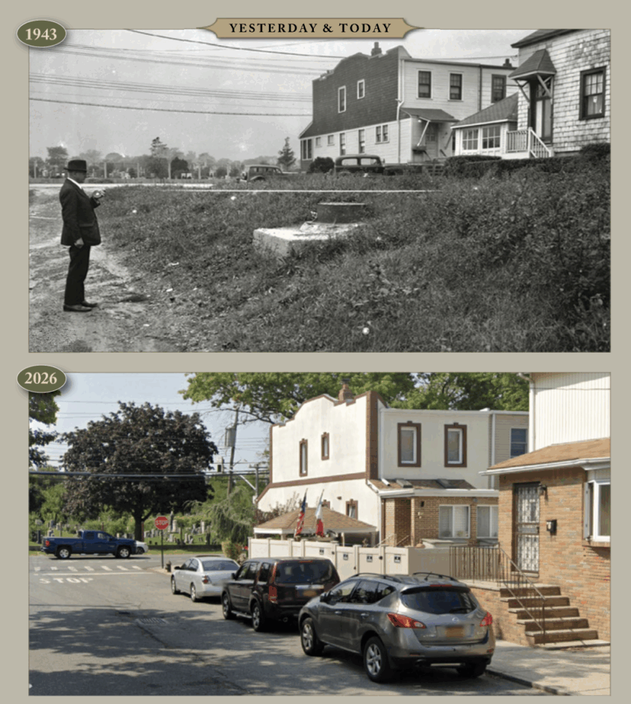
This photo is from 1943 and it shows a surveyor from the Department of Public Works measuring the distance between the property line and the street. In the background is All Faiths (then Lutheran) Cemetery. The height of the recently installed manhole gives a clue that the City had a plan to elevate the street bed. The two houses pictured remain today, although the garage between them is gone. Both houses have been altered but are still recognizable. As progress marched on, the roads were paved and sidewalks were installed. Modern cars have replaced the classic ones shown, and there are a lot more of them today. Also added were a stop sign, crosswalk, and street trees.


© 2020 The Juniper Park Civic Association Inc. All Rights Reserved.
SERVING MIDDLE VILLAGE AND MASPETH SINCE 1938.