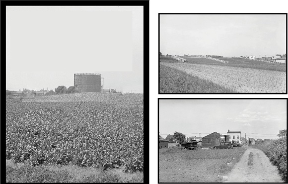
Most people living in the area have heard or read that the site of Juniper Valley Park was once swampland. That is true for the western end of the park, but the sections east of the flagpole were all farmland at one point, as were the areas to the north and south. This photo collection was taken July 2, 1935. The photo on this page faces northeast, and shows the stark contrast between the farm fields in the foreground and the Elmhurst Gas Tanks in the distance. The photo on the top of the opposite page was taken of the farms north of the park, facing east, and shows the 2 twin farmhouses along Dry Harbor Road which were featured in “Yesterday & Today” in the Summer 2018 Juniper Berry. The final photo was taken near 82nd Street looking east along Juniper Blvd North/63rd Avenue toward Dry Harbor Road. Just 5 years later, the entire area had been almost completely transformed from rural to urban. These shots were taken 3 years before the Residents of Juniper Park Homes, the progenitor of the Juniper Park Civic Association, was founded in 1938.


© 2020 The Juniper Park Civic Association Inc. All Rights Reserved.
SERVING MIDDLE VILLAGE AND MASPETH SINCE 1938.