The Woodside area of Newtown was still pretty much wilderness until the Revolutionary War changed that forever. Newtown had the largest group of Patriots. Flushing, Jamaica, and Hempstead, were strong Loyalists. When a small army of Patriots marched through Newtown, 193 men joined the militia. The Declaration of Independence was read aloud on July 5th 1776, in Elmhurst, causing both excitement and fear. The British occupied all of Queens during the war, and held high ground at Cypress Hills & Forest Park. They marched along Flushing and Maspeth Avenues and Broadway, Woodside and Newtown Avenues. The 42nd Highlanders camped out in what would become St. John Cemetery in Middle Village. They occupied the stone Dutch homes such as the Van der Ende Onderdonk House on Flushing Ave, built in the 1600s. They had a large encampment on 39th Ave between Woodside Ave and Queens Plaza. They made a headquarters at the Presbyterian Church on Queens Blvd near Grand Ave, and used the Dutch Reformed Church on Broadway as an ammunition house. The Colonists, or Americans became quickly known for their guerilla tactics, raids, and lawless thievery. The British cut down so many trees for firewood and other uses that sadly, after the war, much of the wilderness of Newtown was gone. They also used up nearly all of the corn, wheat, rye and vegetable stores, so the people of Newtown were nearly starved. Finally when the war was won, the British marched out of Western Queens along Woodside Ave, and across the old penny bridge, and along what would become the BQE. The Penny Bridge, which crossed Newtown creek until its destruction in 1914, was replaced by the Kosciusko Bridge.
Now we come to the Woodside part of our story. Woodside had been part of the Newtown Patent, and we know from James Rikers’ 1852 “Anals of Newtown”, that much of the Newtown area was purchased from Indian Chiefs Rowerowestco and Pomwaukon, in the 1656 land treaty. In Rikers’ book, he lists the names of the farmers, and what they paid for their parcels of land.
The earliest records state that in the 1800s some wealthy southern merchants bought up land and built some impressive mansions in Woodside. In 1826 the father of John A.F. Kelly moved into Woodside, and when John Kelly became part owner of a Brooklyn newspaper, he used to send in little anecdotes about country life, and called them “Letters from Woodside”. This was the first known use of the name for the town or village we know today.
In 1867 a developer by the name of Benjamin Hitchcock bought 115 acres near or on the Kelly Farm, and started selling lots, after filing his claim and creating the Village of Woodside in 1869. However previous to that, in 1854 two Manhattan developers bought land and created a Hamlet called Winfield, after their affection for General Winfield Scott, who was a hero during the War of 1812, but a villain during the Cherokee Trail of Tears of 1838, in which he opposed, but followed orders to enforce a treaty to march about one thousand Indians about a thousand miles, causing mass sickness and deaths among the Cherokee Nation. St. Mary’s, Winfield got its name to distinguish it from St. Mary’s in Long Island City. The Hamlet appears as Winfield Junction on most of the old maps.
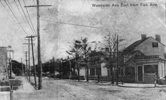
Woodside grew quickly. A railroad station was established at 58th St and 38th Ave. By the 1860s Woodside was known as the largest Irish American neighborhood in Queens. In the 1890s the population doubled, and by 1900 it reached nearly 4,000 people. In 1895 the trolleys became part of the landscape for both Woodside and Maspeth. To backtrack on the story of Maurice Ave, in 1840 James Maurice, a prominent New York lawyer, moved to Maspeth and built a mansion on the south side of Maspeth Ave. He would later be elected to the Assembly and then Congress! In 1882 he donated “Maurice’s Woods” (today’s Ridgewood Plateau area) to the Episcopal Church for school purposes, but it was never used to build the school. It remained a wilderness area and park, but by the 1920s the church sold the land to developers and it was swallowed up by buildings and streets.