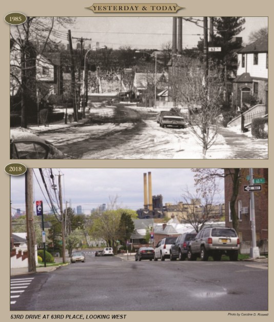
The site of the Maspeatches Indian Village, although in Maspeth, was on the Ridgewood Plateau. Photo taken at 53rd Drive and 63rd Place, down the road from O’Neill’s Restaurant. You can see Mt. Zion Cemetery in the background. The area was named Ridgewood Plateau by real estate developers, although it is an actual plateau as characterized by its steep hills.
Today there are too many PVC fences and overgrown trees to have taken the photo from the exact same spot as the old photo, so we are standing a block closer at 63rd St. Some landmarks remain such as the light pole on the right and the telephone poles on the left. The houses are much the same, including the dome shaped roof, and the iron fence and wall that are in the older photo are still there as well. The plateau area of Maspeth is one of the more architecturally stable sections of town, and hopefully the proposed one-family rowhouse zone will be adopted to help keep it that way. – Caroline D. Roswell