Zip Code and neighborhood maps are peculiar things, sometimes. Boundaries between them don’t always follow notable features like Woodhaven Boulevard, Queens Boulevard or the Long Island Expressway. Most of my first 38 years of existence were spent in a few block area with those fuzzy geographical boundaries. 32 of those years were spent in a radius of just a couple of blocks at the juncture of Rego Park, Middle Village and Elmhurst. Since that time, some of the boundaries were redrawn and the Elmhurst portion of my history was merged with Middle Village.
For the first six years of my existence I was in the postal code of Woodside but south of Queens Boulevard in an area that is mostly identified as Maspeth. I hadn’t been back to this area in many decades, save the rare drive down Queens Boulevard. A recent article by Forgotten New York, of which I’m an avid fan, highlighting Laurel Hill Boulevard, prompted me to think back in time to the neighborhood of my youth.
Things I remembered through the eyes of someone less than six years old in the 1960s were the busy Queens Boulevard crossing of the BQE, the triangle park and the IGA store at Laurel Hill Boulevard and 65th Place, Pitney Bowes office machine business at 67th Street and Queens Boulevard where mom picked up discarded rolls of paper for me to draw on, the afternoon session of kindergarten at PS-229 and the Big 6 apartment complex. I also have vivid memories of walking on 65th Place north of Queens Boulevard to Roosevelt Avenue and 61st Street to the 7 train station and malingering on the platform watching the sunset and 7 trains and LIRR trains coming and going after a day out in the City. Roosevelt Avenue back in the day was also home to a couple of bakeries, Walter’s with the chocolate sprinkled ring cakes on 61st Street, and Aiello’s on Roosevelt Avenue with the marzipan confections in shapes of animals that I couldn’t get enough of back in the day. In a spur-of-the-moment idea, on a Friday when my family had other things in mind during after work hours, I decided to take a detour on the way home and see what I remembered and what it looks like today.
It was a cool and windy afternoon, temperature around 60 degrees, humidity next to zero and not a cloud in the sky. I’ll pick up the action walking westward on Queens Boulevard from Grand Avenue to 51st Avenue and continuing on 51st to where merges with Calamus Avenue and turns into Maurice Avenue. A notable feature that I crossed is the CSX railroad freight tracks highly elevated over 51st Avenue and the main line LIRR, less elevated than the freight line. Wondering why and with a slight detour, it becomes apparent that the elevations are different due to the crossing of the two lines just a few hundred feet to the southeast.
Returning to the mission at hand, I continued back to 51st Avenue and encountered PS-229. It appears that the school was expanded over time, gauging by the slight differences in looks of the various wings of the building. As I turned on 66th Street and walked north, I was immediately greeted with a clean kept block with large trees that arched over the street. Some of the original houses were apparently reconstructed and expanded as is typical. Passing by my former home, I noted that it was still there and it appeared to have a new entry door and recent power washing of the brick facade. All in all, it looked as I remembered it.
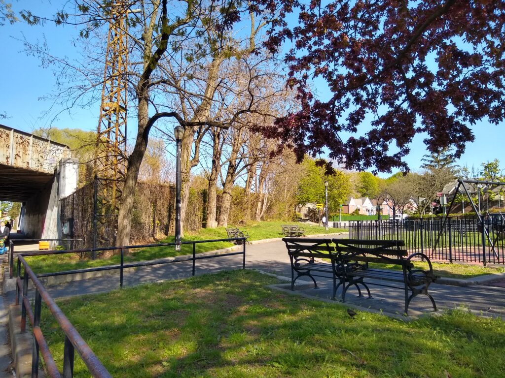
Backtracking on 65th Place I went past The Corner Deli that was originally the IGA store and zigzagged my way through similar nicely kept blocks. I didn’t specifically remember this part of the neighborhood, roughly triangular in shape bounded by Laurel Hill Boulevard, 65th Place and Tyler Avenue on the edge of Mt. Zion Cemetery. Immediately noticeable was the apartment complexes on the Ridgewood Plateau towering over the cemetery to the east and the stacks of the inactive Department of Sanitation Incinerator on 58th Street on the west.
Looping around back to Laurel Hill Boulevard and 61st Street I crossed under the BQE and found another reminder of the past, the Big 6 apartment complex (above) with a shopping center right in its midst. I remember how my mom thought that living there must have been an experience of luxury. Walking back west on Queens Boulevard a couple of blocks, I encountered the firehouse that serves as a base for Rescue 4 and Engine 292 (right) and the memory of how big the doors seemed to a youngster.
My next goal was to make it up to Roosevelt Avenue and 61st Street. It didn’t take long for me to remember the hill involved in getting from Queens Boulevard to Roosevelt. I went north on 65th Place to Roosevelt Avenue and turned left. I didn’t expect to find the same bakeries there but the memory of the shadows beneath elevated subway and LIRR tracks came back right away.
The walk was a mere four and a half meandering miles and it was time to get back on the 7 Train but not without a few snaps of the scenery from the platform. The circular sig- nal lights of the LIRR tracks were still there but the original three dot vertical to diagonal to horizontal patterns were replaced with red and green lights. It was still well before sunset so I didn’t get the vibe of being on the platform with the changing sky colors but a it was still amazing on a sun drenched early evening.
I would be remiss if I didn’t mention that on the 7 train, I found myself among the throngs of fans headed to the Mets game. I was in a mood to get myself a ticket, a hot dog and a beer instead of heading directly home. I resisted this temptation in favor of shuttling kids around and, with my typical luck, five Mets pitchers combined for a no-hitter that night!